Read the stories of four that either survived or succumbed to the flames, and how they reemerged from the ruins.


Accurate navigational sea-charts maps were essential for seafarers to find their way and for newly discovered lands to be made known. Maps, atlases and charts (or platts as they were called) were often not just essential tools but also works of art with beautiful colouring and embellishments showcasing the skills of the map-maker.

In the 17th century, the Dutch were unsurpassed leaders in the field of map-making. England was far behind and needed to keep up with better, newer maps to match the maritime discoveries being rapidly made and expanding overseas commercial interests.
A small group of chartmakers, operating east of the Tower of London, in and around the alleyways leading down to the Thames waterfront, helped challenge this Dutch monopoly and start a new age of English map-making.
Pepys was a collector of maps and regularly made visits to the Thames School makers: ‘and so by water to Ratcliffe, and there went to speak with Cumberford the platt-maker, and there saw his manner of working, which is very fine and laborious’.
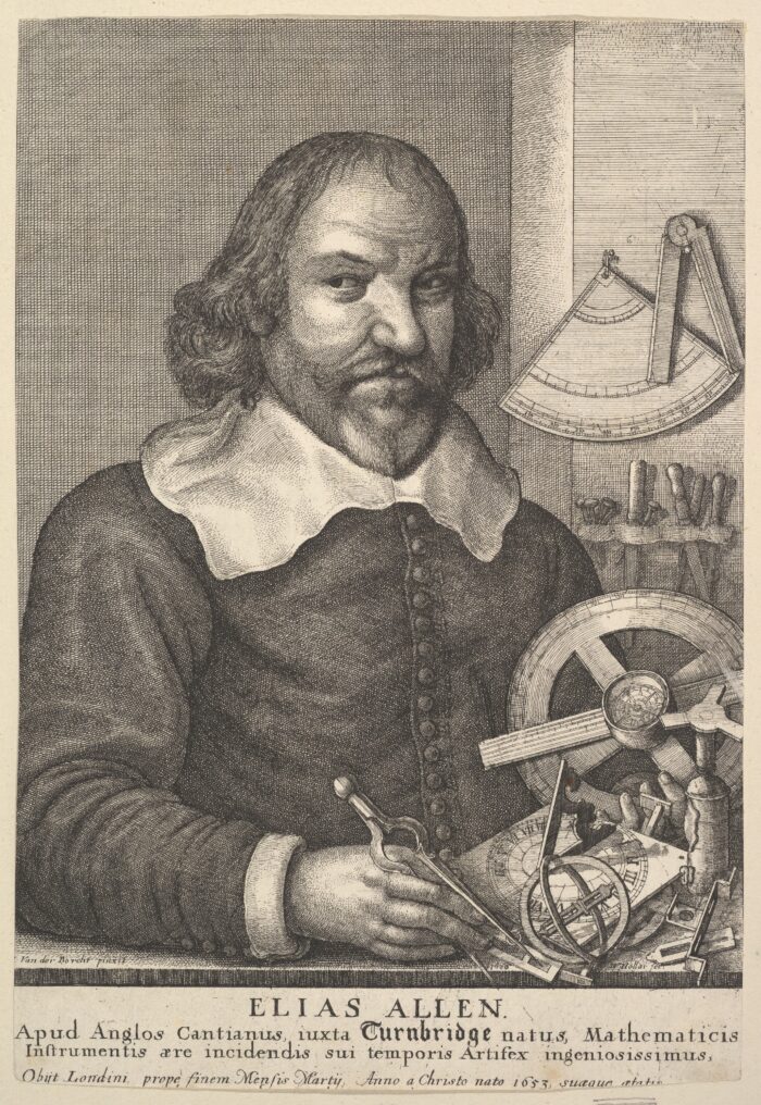
Find out more about the state-of-the-art instruments needed to make these maps.
John Thornton was also one of the ‘Thames school’ and a foremost cartographer of the day. Baptised, married and buried at St Botolph’s, he published, printed and sold navigation charts for mariners travelling to Asia and North America. His shop in the Minories (the street opposite the church) was advertised by the sign ‘of England, Scotland and Ireland’ (a signboard that hung outside the shop).

John Thornton: 'Atlas maritimus or, the sea-atlas', Library of Congress, Geography and Map Division.
He was one of the first map-makers to move from hand-drawn manuscript maps to printing. He and a number of other cartographers in the Thames School collaborated with leading map-maker John Seller on his first English printed maritime atlas, Atlas maritimus. A large group of John Thornton maps survive today showing his important output. Amongst these is the English Pilot. The Fourth Book (1689), co-published with William Fisher and covering the English colonies in North America and the West Indies.
Map mappers’ skills and knowledge were passed on one to another through the system of apprenticeship. In the same way that John learnt from master maker, John Burston, he too passed on his knowledge to his apprentices. One of these was Joel Gascoyne, who came to be considered one of the greatest map-makers and surveyors of the late 1600s, setting new standards of accuracy.
After John Thornton’s death in 1708, his business was continued briefly by his son. However, Samuel died shortly afterwards, leaving the business’s stock to be bought by Mount & Page, known worldwide in the 18th century for their nautical charts.
Read the stories of four that either survived or succumbed to the flames, and how they reemerged from the ruins.

Keep up to date with the latest news ...


